
Cybaeodamus meridionalis Lise, Ott & Rodrigues, 2009
|
publication ID |
https://doi.org/ 10.5281/zenodo.3693112 |
|
DOI |
https://doi.org/10.5281/zenodo.3693175 |
|
persistent identifier |
https://treatment.plazi.org/id/039DC433-FFC4-3A6A-1595-4CA3FD1EFCDE |
|
treatment provided by |
Cbelab20 |
|
scientific name |
Cybaeodamus meridionalis Lise, Ott & Rodrigues, 2009 |
| status |
|
Cybaeodamus meridionalis Lise, Ott & Rodrigues, 2009 View in CoL
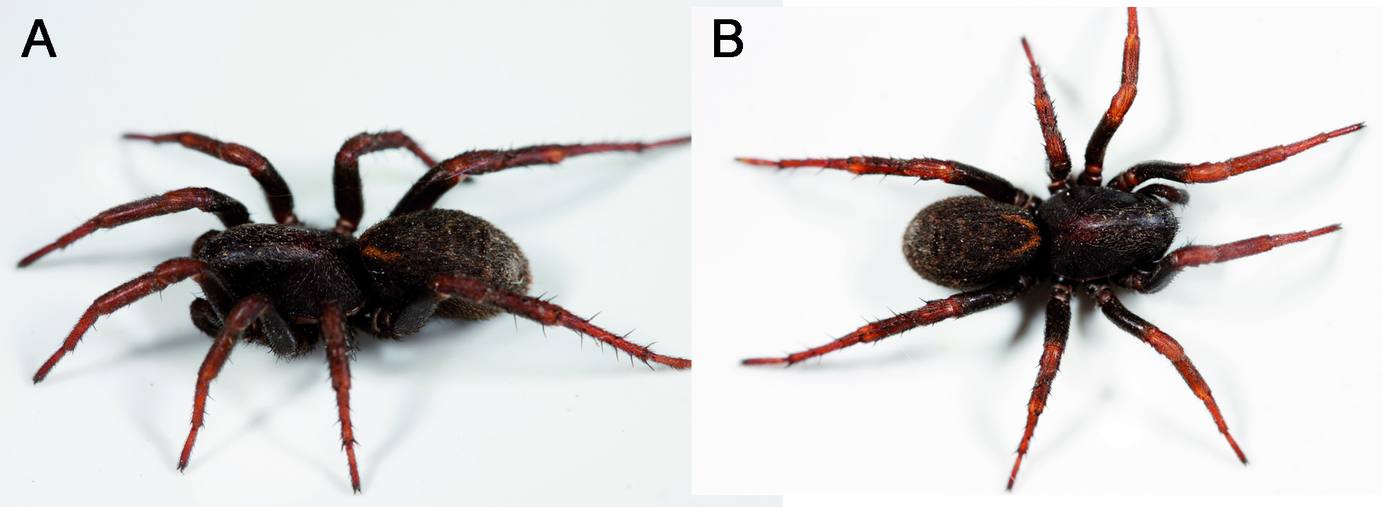
( Fig. 5 View Fig )
Cybaeodamus meridionalis Lise, Ott & Rodrigues, 2009: 260 View in CoL , f. 1-20
Type locality: BRAZIL, Rio Grande do Sul: Xangrilá .
New records. ARGENTINA: Corrientes: San Cayetano: Estación Biológica de Corrientes (EBCo) , S 27° 33’00.9”, W 58° 40’41.3”, elev. 62 m, 11–16.XI.2007, savanna with Trithrinax palms, pitfall, C. Grismado & L. Compagnucci coll., 2♂ ( MACN-Ar 13184 , preparations CJG 1484 , 3003) GoogleMaps . Santa Fe: San Justo: Ruta Nac. 11, 9 km S Videla , S 31.025681° W 60.701673° (GPS, +- 10m), elev. 44 m (GPS), 19.III.2014, grassland, hand collecting, M. Ramírez, C. Grismado, L. Piacentini & M. González Márquez coll. ( MJR-Loc-158 ) 1 ♀, ( MACN-Ar 31354 ; photos MJR 45-53 , tissue sample preparation CJG-3315 ) GoogleMaps ; Calchaquí: Laguna El Cristal (ca. S 30° 01’ W 60° 06´), 7. XII. 2010, pitfall, I. Ortega Insaurralde et al. coll. 1 ♂, 2♀; ( MACN-Ar 27476 ) GoogleMaps . Entre Ríos: Paraná: La Picada , S 31° 40’ W 60° 11’, I-IV.2004, soybean and edges with spontaneous vegetation, pitfall, F. Weyland coll., 1♂ ( MACN-Ar 33553 ) GoogleMaps ; Colón: Parque Nacional El Palmar (ca. S 31° 52’ W 58° 18’), 22– 23. XI. 2003, grassland with Butia yatay palms, pitfall, C. Grismado, A. Ojanguren & F. Labarque coll., 2 ♂, 1♀, 3 immatures ( MACN-Ar 33554) GoogleMaps ; Parque Nacional Predelta, “ Campo Sarmiento ”, 6 km S Diamante, S 32.12182° W 60.62525° (GPS,+- 100m), elev. 39m, 30.IV.2013, grassland at sides of “Chilcal”, hand collecting, M. Ramírez, L. Piacentini, M. González Márquez, A. Laborda & S. Aisen coll. ( MJR-Loc-141 ), 1subadult ♂ ( MACN-Ar 30814 ) GoogleMaps .
Natural history. The Argentine specimens here listed were collected in areas belonging to the Chaco Biogeographic Province (records from Corrientes) and to the northern, ecotonal areas of the Pampean Biogeographic province (sensu Morrone, 2014) bordering with the former. They were found in habitats ranging from savannas and grasslands with different palm species to cultivated, disturbed areas. Most of the specimens were obtained with pitfall traps, but the female from San Justo, Santa Fe ( Fig. 5 View Fig ) was found by manual searching the bases of grasses in an area with a mixture of natural and adventitious vegetation along the roadside. The female from Parque Nacional El Palmar shows the distal part of amale embolusinserted intotheepigynum.
No known copyright restrictions apply. See Agosti, D., Egloff, W., 2009. Taxonomic information exchange and copyright: the Plazi approach. BMC Research Notes 2009, 2:53 for further explanation.
|
Kingdom |
|
|
Phylum |
|
|
Class |
|
|
Order |
|
|
Family |
|
|
Genus |
Cybaeodamus meridionalis Lise, Ott & Rodrigues, 2009
| Grismado, Juan Manuel Andía & Cristian J. 2015 |
Cybaeodamus meridionalis Lise, Ott & Rodrigues, 2009: 260
| Lise, Ott & Rodrigues. 2009: 260 |