
Macroeubria Pic, 1916
|
publication ID |
https://doi.org/ 10.1649/0010-065X-73.2.259 |
|
persistent identifier |
https://treatment.plazi.org/id/039E7B39-FFD0-FFF5-8D38-FF2DFD07FBD5 |
|
treatment provided by |
Valdenar |
|
scientific name |
Macroeubria Pic, 1916 |
| status |
|
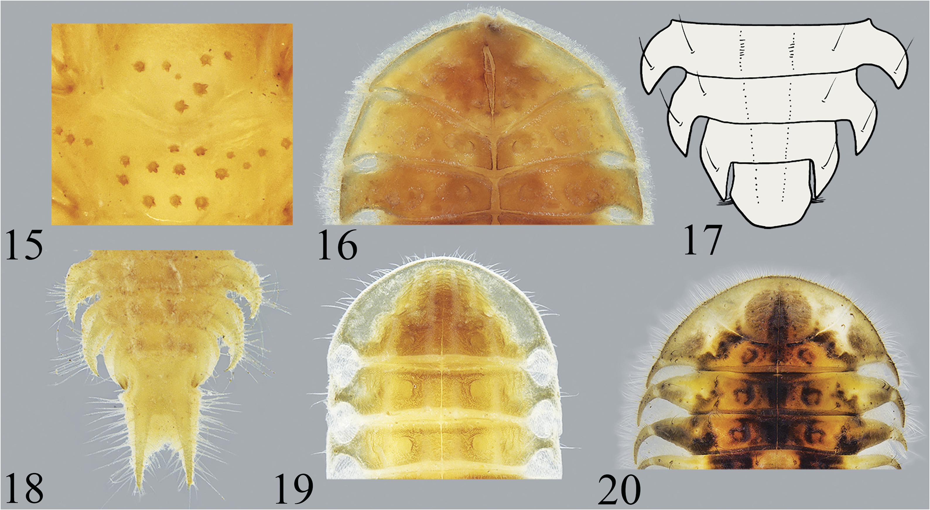
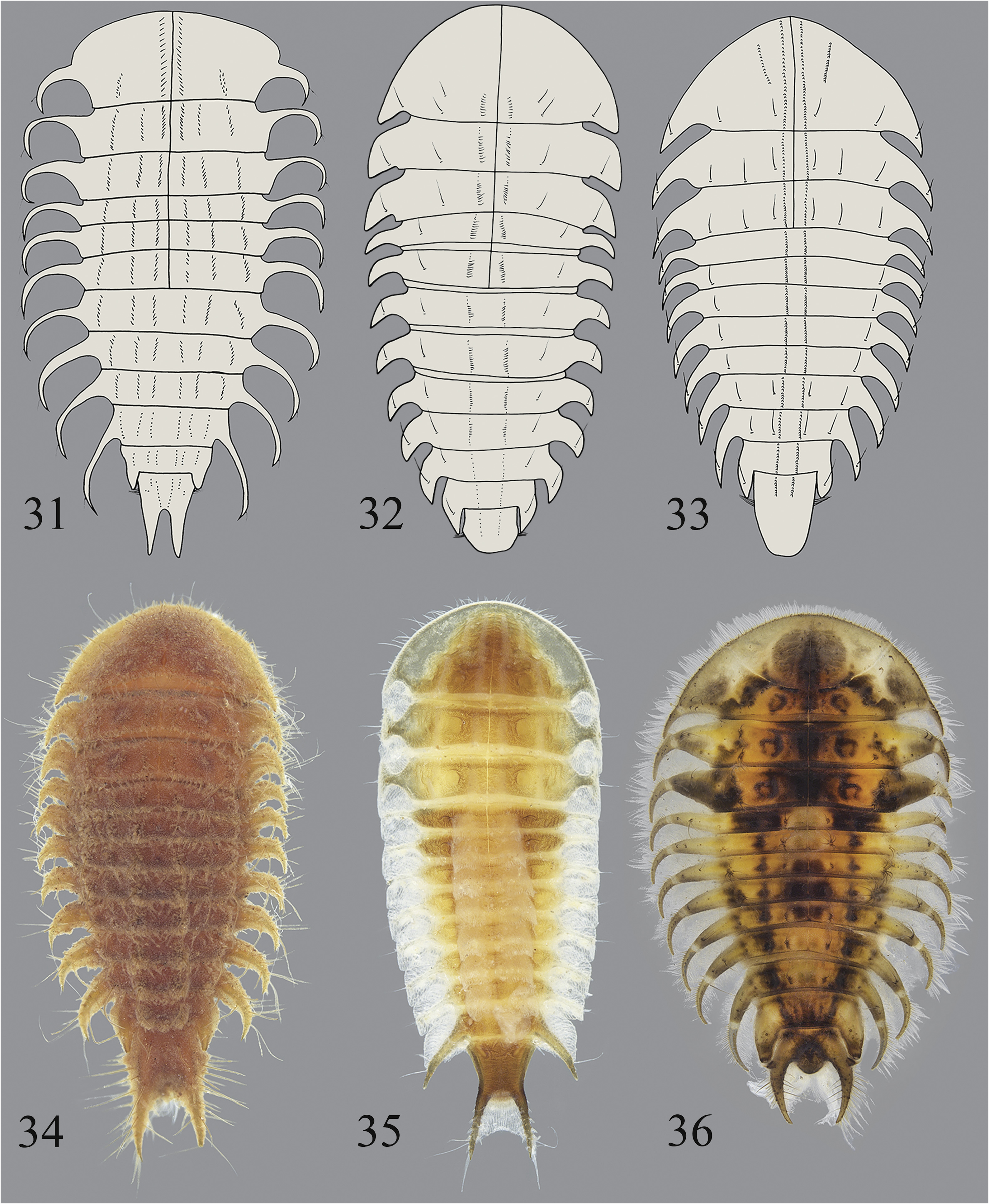
Figs. 18 View Figs , 34 View Figs , Map C
Discussion. Macroeubria is a moderately sized genus with 21 species and was reviewed by Lee et al. (1999). Larvae are found on submerged twigs, and adults have been collected at lights. The species are distributed in Bhutan, China, Thailand, Laos, Malaysia, Indonesia, the Philippine Islands, Japan, and Taiwan. Five species are known to occur in Thailand: Macroeubria bella Lee, Yang, and Satô, 1999 ; Macroeubria contracta Lee, Yang, and Satô, 1999 ; Macroeubria diffusa Lee, Yang, and Satô, 1999 ; Macroeubria fulva Lee, Yang, and Satô, 1999 ; and Macroeubria impressicollis Pic, 1934 . They occur in Banna ( M. bella ); Mae Hong Son Province: Ban Si Lang, Yala Province: Betong ( M. contracta ); Chiang Mai Province: Chiang Dao, Doi Sutep, Thanon Thong Chai, Phuket Province: Palong ( M. diffusa ); Yala Province: Betong ( M. fulva ); Nan Province: Mae Charin WF ( M. impressicollis ) (Lee et al. 1999; Lee 2016).
Material Examined. Chiang Mai Province: Doi Inthanon National Park, Nam Mae Aep above Road 1009, gravel, 630 m, 18°32’N 98°32’E, 13 November 2002, P. Thamsenanupap (1L); same locality, 15 February 2003, P. Thansenanupap (1L); same locality, 6 December 2002, P. Thansenanupap (1L); Doi Inthanon National Park, Namtok Siriphum, 1460 m, 18°32’N 98°31’E, 14 March 2003, CMU team (1L); Doi Inthanon National Park, Mae Klang River at Ecolodge, leaf pack, 1000 m, 18°32’N 98°32’E, 2 April 2003, L-437, UMC and CMU teams (2L); same locality, 7 December 2002, CMU team (1L); same locality, 15 February 2003, CMU team (1L); same locality, 7 xii 02, P. Thamsenanupap & Prommi (1L); same locality, 2 May 2003, L-494, UMC and CMU teams (1L); Doi Inthanon National Park, Mae Pan waterfall, gravel, 1100 m, 18°31’N 98°27’E, 3 April 2003, L-442, Sites, AV, Seetaphan (1L); Doi Inthanon National Park, Mae Pan Noi at Ban San, Pathana; bedrock stream, 18°31’N 98°25’E; 750 m, 4 April 2003, L- 446, UMC and CMU teams (1L); Doi Inthanon National Park, stream from Namtok Huay Sai Luang, 18°31’N 98°27’E, 1060 m, 8 May 2002, L- 396, UMC & CMU teams (1L); Doi Sutep National Park, Huay Kaew @ Namtok Sai Yoi, gravel, 1100 m, 18°48’N 98°55’E, 12 III 2003, P. Thamsenanupap (1L); Doi Sutep National Park, Huai Sa Lad, 3394 ft, 18°48.31’N 98°54.52’E 24 III 1994, (WDS-A-1043 on reverse), William D. Shepard (1L); Doi Suthep National Park, Namtok Monthathan, 700 m, 18°49’N 98°55’E, 10 December 2002, CMU team (2L); same locality, 14 February 2003, CMU team (1L); same locality, 24 III 1994, (WDS-A-1044 on reverse), William D. Shepard (2L); Doi Sutep-Pui National Park, Pa Ngerb, 530 m, 18°48’N 98°56’E, 29 Mar 2003, L-426, UMC and CMU teams (2L); same locality, 11 January 2003, CMU team (1L). Kanchanaburi Province: Amphur Thong Pha Phum, Huay Ka Yaeng at Ban Padsadoo Klang, 296 m, 14°33’N 98°34’E, 9 Apr 2003, L-457, Sites, Vitheepradit, Prommi, Seethapan (2L). Mae Hong Son Province: Huay Pha, <1 km N Ban Huay Pha, stream, 360 m, 19°25.847’N 97°59.827’E, 19 April 2009, L-1049, Sites, Vitheepradit Prommi (14L). Nakhon Si Thammarat Province: Nopphitam, Ban Pitam, 14.9 km NW int. Hwy 4140 X 4186, gravel stream, 98 m, 08°47’N 99°39’E, 30 April 2002, L-383, Vitheepradit & Kirawnich (1L); Nopphitam Khlong Yod Leung, 78 m, 08°38’N 99°44’E, stream, 26 May 2005, L-800, Sites, Vitheepradit & Prommi (11L). Phayao Province: Namtok Champatong, bedrock, 620 m, N 19°14’ E 99°45’, 24 II 2003, coll. Arthit, 1L. Phrae Province: Wieng Ko Sai Natl. Park, Namtok Punjane, leaf pack, 430 m, 17°56’N 99°34’E, 28 March 2003, L-424, Sites, Vitheepradit, Prommi (1L); Wieng Ko Sai N. P., upper Nam Panjane 295 m, 17°56’N 99°34’E, 20 Feb 03, CMU team (2 L); Wieng Ko Sai Natl. Park, Namtok Punjane (upper), leaf pack, 17°57’N 99°34’E, 22 April 2003, CMU team (1L). Satun Province: 60 km SW of Amphur Hat Yai, 100 m downstream from Boripat Waterfall, 200 m, 6°59’N 100°9’E, 10 Jun 2001, L-245, R. W. Sites (2L). Songkhla Province: Khao Nam Khang National Park, 102 km SE of Amphur Hat Yai, Amphur Na Tawee, 100 m, 6°36’N 100°36’E, 15 Jun 2001, L- 246, R. W. Sites (1L); Ton Nga Chang National Park, stream at Buddist temple, 44 m, 6°56’N 100°15’E, 6 July 1997, L-127, R. W. Sites (2L); same locality, 9 June 2001, L-243, R. W. Sites (2L).
| CMU |
Chiang Mai University |
| R |
Departamento de Geologia, Universidad de Chile |
No known copyright restrictions apply. See Agosti, D., Egloff, W., 2009. Taxonomic information exchange and copyright: the Plazi approach. BMC Research Notes 2009, 2:53 for further explanation.
|
Kingdom |
|
|
Phylum |
|
|
Class |
|
|
Order |
|
|
Family |