
Cheiracanthium leucophaeum Simon, 1897
|
publication ID |
https://doi.org/10.11646/zootaxa.3857.3.1 |
|
publication LSID |
lsid:zoobank.org:pub:D2A7F86B-7E6C-464A-9935-625C0371E8BD |
|
DOI |
https://doi.org/10.5281/zenodo.6124076 |
|
persistent identifier |
https://treatment.plazi.org/id/882987D0-FFA2-FFE8-2189-FB5E5D1551DF |
|
treatment provided by |
Plazi (2016-04-17 13:29:51, last updated 2024-11-29 15:32:13) |
|
scientific name |
Cheiracanthium leucophaeum Simon, 1897 |
| status |
|
Cheiracanthium leucophaeum Simon, 1897
Cheiracanthium leucophaeum Simon, 1897: 502 ; Lotz, 2007a: 40, figs 70–77.
Diagnosis. Females of C. leucophaeum are differentiated by the two closely spaced spermathecal spheres, and the males by the small tibial and cymbial apophyses ( Lotz 2007a: figs 73, 76–77).
Description. Lotz (2007a) described and illustrated both sexes.
New records from material examined from Madagascar: 18♂ 13♀, Antsiranana, Park National Montagne d’Ambre, 12º32’04”S, 49º10’46”E, 20–26.I.2001, various collectors ( CASC 9000742, 9000748, 9001095, 9001165, 9001166, 9001167, 9001168, 9001169, 9003664, 9003665, 9006670, 9008332); 3♂ 4♀, Antsiranana, Park National Montagne d’Ambre, 12º30’52”S, 49º10’53”E, 2001, various collectors ( CASC 9001636, 9001663, 9001677); 16♂ 14♀, Antsiranana, Park National Montagne d’Ambre, 12º31’13”S, 49º10’45”E, 2001, R. Harin’Hala ( CASC 9001728, 9001729, 9001748, 9001749, 9001772, 9001773, 9001806, 9001808, 9001809, 9001839, 9001848, 9001850, 9001858, 9001872, 9001887, 9001913, 9001915); 18♂ 26♀, Antsiranana, Park National Montagne d’Ambre, 12º35’47”S, 49º09’34”E, 2–7.II.2001, various collectors ( CASC 9003560, 9003561, 9003562, 9004496, 9006919, 9006921, 9007893, 9007894); 10♂ 4♀, Antsiranana, Sakalava Beach, 12º15’46”S, 49º23’51”E, 2001, R. Harin’Hala ( CASC 9001928, 9001938, 9001952, 9001960, 9001962, 9001977, 9001999, 9002023); 3♀, Antsiranana, Montaigne Francais, 12º18’08”S, 49º38’51”E, 6–20.III.2001, R. Harin’Hala ( CASC 9002034); 6♂ 4♀, Antsiranana, 7 km N of Jeffreville, 12º20’S, 49º15’E, III–V.2001, R. Harin’Hala ( CASC 9002081, 9002082, 9002083, 9002118, 9002136, 9002150); 1♂, Antsiranana, Réserve Spéciale de l’Ankarana, 22.9 km 224ºSW Anivorano Nord, 12º54’32”S, 49º06’35”E, 10–16.II.2001, J.J. Rafanomezantsoa, et al. ( CASC 9002434); 2♂ 1♀, Antsiranana, Ampasindava, Forêt d’Ambilanivy, 3.9 km 181ºS Ambaliha, 13º47’55”S, 48º09’42”E, 9–4.III.2001, Fisher, Griswold, et al. ( CASC 9007364); 7♂ 2♀, Antsiranana, Nosy Be, Réserve Naturelle Intégrale de Lokobe, 6.3 km 112ºESE Hellville, 13º25’10”S, 48º19’52”E, 19–24.III.2001, Fisher, Griswold, et al. ( CASC 9007988); 14♂ 13♀, Antananarivo, Réserve Spéciale d’Ambohitantely, Forêt d’Ambohitantely, 20.9 km 72ºNE de Ankazobe, 18º13’31”S, 47º17’13”E, 17–22.IV.2001, Fisher, Griswold, et al. ( CASC 9001212); 1♀, Antananarivo, Station Forrestiere Angavokely, 22 km E Antananarivo, 18º55’S, 47º45’E, 8.IX.2001, D. Andriamalala, et al. ( CASC 9001372); 143♂ 51♀, Antananarivo, 3 km 41ºNE Andranomay , 11.5 km 147ºSSE Anjozorobe , 18º28’24”S, 47º57’36”E, 5–13.XII.2000, Fisher, Griswold, et al. ( CASC 9003903, 9004027, ex 9004029, 9004385, 9004386, 9004387, 9006606, 9006607, 9006608); 2♂, Fianarantsoa, Park National Ranomafana, Talatakely, 21.25041ºS, 47.41945ºE, I.2001, D.H. & K.M. Kavanaugh, et al. ( CASC 9003402, 9003498); 2♂, Fianarantsoa, Park National Ranomafana, Vohiparara, broken bridge, 21º13.57’S, 47º22.19’E, 28.XI–6.XII.2001, R. Harin’Hala ( CASC 9010513); 5♂ 2♀, Fianarantsoa, Vohiparara, 21º14’S, 47º24’E, 5–7.XII.1993, N. Scharff, et al. ( CASC); 14♂ 2♀, Mahajanga , Park National Tsingy de Bemaraha, 2.5 km 62ºENE Bekopaka, Ankidrodroa River, 19º07’56”S, 44º48’53”E, 11–15.XI.2001, Fisher, Griswold, et al. ( CASC 9008684, 9009146, 9009237); 5♂ 6♀, Mahajanga , Park National Tsingy de Bemaraha, 10.6 km 123ºESE Antsalova, 19º42’34”S, 44º43’05”E, 16–20.XI.2001, Fisher, Griswold, et al. ( CASC 9009302, 9009389, 9009738); 21♂ 7♀, Toliara, Park National dAndohahela, Col du Sedro, 3.8 km 113ºESE Mahamavo, 37.6 km 341ºNNW Tolagnaro, 24º45’50”S, 46º45’06”E, 21–25.I.2002, Fisher, Griswold, et al. ( CASC 9009486, 9009556, 9009874, 9012352); 1♀, Toliara, Fort Dauphin, Mount Mahermano, 24º26’S, 47º13’E, 27.I.1995, K. Emberton ( MRAC 202847).
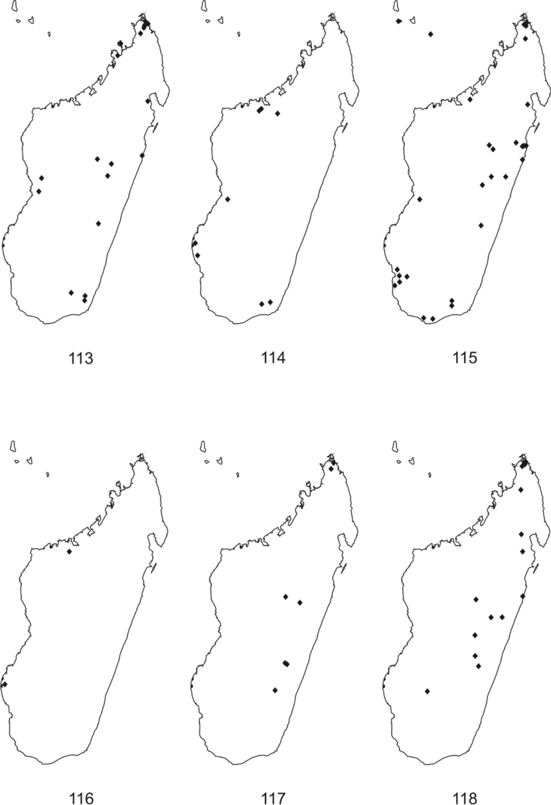
Distribution. Several localities throughout Madagascar ( Fig. 113 View FIGURES 113 – 118 ).
Habitat. From littoral forest to high altitude rainforest, including dry forests.
Lotz, L. N. (2007 a) The genus Cheiracanthium (Araneae: Miturgidae) in the Afrotropical Region. 1. Revision of known species. Navorsinge van die Nasionale Museum, Bloemfontein, 23, 1 - 76.
Simon, E. (1897) Description d'Arachnides nouveaux. Annales de la Societe Entomologique de Belgique, 41, 8 - 17.
| MRAC |
Musée Royal de l’Afrique Centrale |
No known copyright restrictions apply. See Agosti, D., Egloff, W., 2009. Taxonomic information exchange and copyright: the Plazi approach. BMC Research Notes 2009, 2:53 for further explanation.
|
Kingdom |
|
|
Phylum |
|
|
Class |
|
|
Order |
|
|
Family |
|
|
Genus |
Cheiracanthium leucophaeum Simon, 1897
| Lotz, L. N. 2014 |
Cheiracanthium leucophaeum
| Lotz 2007: 40 |
| Simon 1897: 502 |
1 (by plazi, 2016-04-17 13:29:51)
2 (by ImsDioSync, 2016-12-31 09:31:42)
3 (by ImsDioSync, 2016-12-31 09:33:47)
4 (by ImsDioSync, 2017-02-09 17:17:30)
5 (by ImsDioSync, 2017-06-18 17:26:43)
6 (by ExternalLinkService, 2019-09-26 14:02:27)
7 (by ExternalLinkService, 2022-01-30 04:45:21)
8 (by ExternalLinkService, 2022-02-17 15:05:24)
9 (by plazi, 2023-10-26 22:44:25)