
Linguimaera tias Krapp-Schickel, 2003
|
publication ID |
https://doi.org/ 10.11646/zootaxa.4115.1.1 |
|
publication LSID |
lsid:zoobank.org:pub:C0CF41A3-40FB-428E-8933-02115AB0F6E3 |
|
DOI |
https://doi.org/10.5281/zenodo.5306725 |
|
persistent identifier |
https://treatment.plazi.org/id/D8297B13-4D61-5A1E-65AF-3E87FDD6F8E9 |
|
treatment provided by |
Plazi |
|
scientific name |
Linguimaera tias Krapp-Schickel, 2003 |
| status |
|
Linguimaera tias Krapp-Schickel, 2003
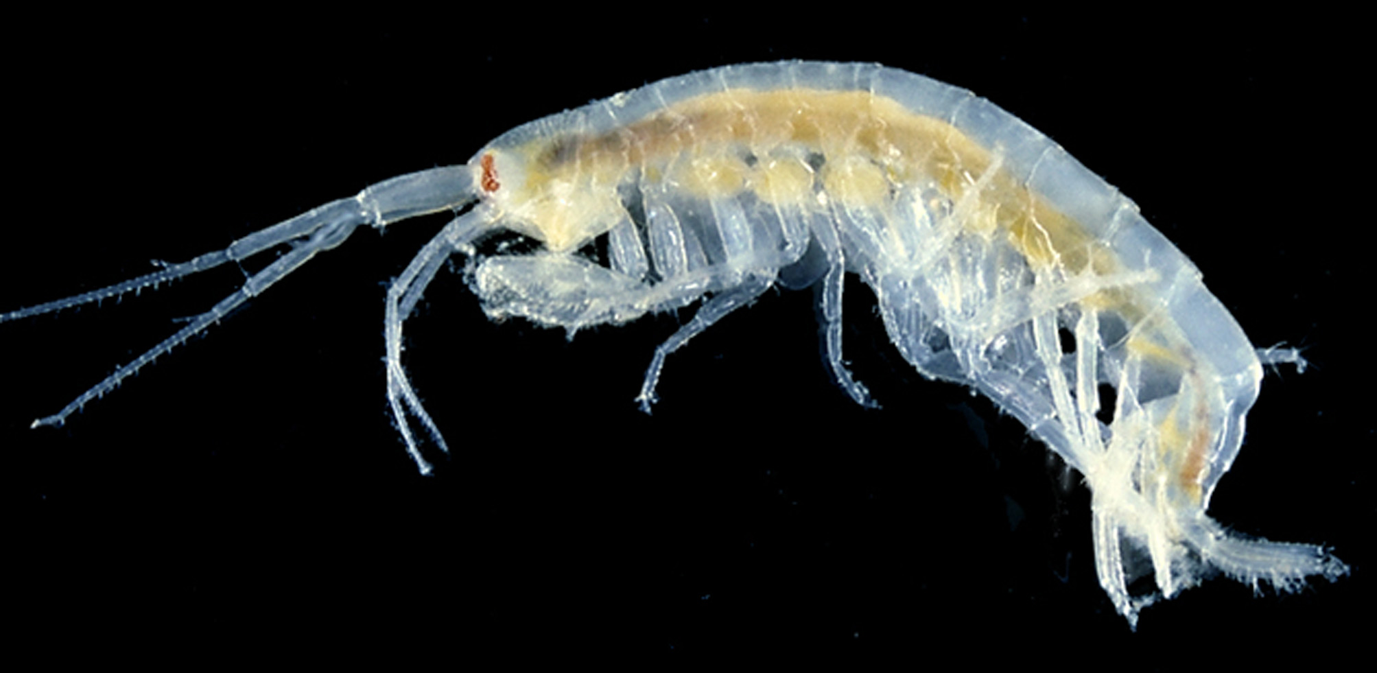
( Fig. 59 View FIGURE 59 )
Maera mastersi .— Barnard, 1972b: 108, figs 55–56.— Sheard, 1936: 177, fig. 3.— Sheard, 1937: 24.
Maera mastersii .— Hale, 1929: 215, fig. 213.— Chilton, 1916: 367.— Chilton, 1925: 317.— Hurley, 1954: 603.— Lowry & Fenwick, 1983: 236.
Linguimaera tias Krapp-Schickel, 2003: 277 , figs 13–15.— Lowry & Springthorpe, 2005: 238, 247.— Krapp-Schickel, 2008: 22.
? Moera mastersi .— Chilton, 1911: 564.— Chilton, 1921: 72.
not Megamoera mastersii Haswell, 1879b: 265 , pl. 1, fig. 1.
Material examined. New South Wales: 1 specimen, AM P.97880, east of Bermagui (36°26′S 150°14′06″E), 119– 122 m, 5 September 1994, benthic sled, coll. P.B. Berents, RV Southern Surveyor (SS05/94/155) GoogleMaps ; 1 specimen, AM P.62906, Black Rock , south of Smoky Cape (30°56′58″S 153°04′32″E), 13 m, under stones, airlift on SCUBA, 13 February 2002, coll. R.T. Springthorpe ( NSW 1870 View Materials ) GoogleMaps .
South Australia: 2 specimens, SAMA C6504, northern side of Point Ellen Reef , Vivonne Bay, Kangaroo Island (35°59′13″S 137°12′25″E), 2.5 –7.5 m, boulders, sand, 26 January 1989, coll. W. Zeidler and K. Gowlett- Holmes GoogleMaps ; 2 specimens, SAMA C6503, Headland near Chinaman’s Hat Island, Yorke Peninsula (35°17′19″S 136°55′04″E), just below low water mark, 6 November 1976, coll. W. Zeidler and I.C. Kowanko GoogleMaps ; 6 specimens, SAMA C7866, western side of Whittlebee Point , east of Ceduna (32°19′59″S 133°11′59″E), depth unknown, 7 March 1993, coll. W. Zeidler , K. L. Gowlett-Holmes and B. McHenry GoogleMaps .
Western Australia: 4 specimens, AM P.79363, reef west of groyne, 2 km south of Cape Peron (32°16′S 115°41′E), 6 m, deep channels in limestone reef, sponges, gorgonaceans from cave in reef, 26 December 1983, coll. J.K. Lowry (WA 295) GoogleMaps ; 13 specimens, AM P.79415, near Mistaken Island, Vancouver Peninsula , King George Sound (35°04′S 117°56′E), 6 m, seagrass, 13 December 1983, coll. R.T. Springthorpe (WA 121) GoogleMaps ; 4 specimens, AM P.79468, Bramble Point , Princess Royal Harbour, Albany (35°03′S 117°53′E), 1.5 m, seagrass Poisidonia australis , January 1988, coll. P.A. Hutchings (site 5) GoogleMaps ; 5 specimens, AM P.79467, Bramble Point , Princess Royal Harbour, Albany (35°02′S 117°55′E), 1.5 m, seagrass Posidonia australis , January 1988, coll. P.A. Hutchings (site 4) GoogleMaps ; 1 specimen, AM P.79464, Bramble Point , Princess Royal Harbour, Albany (35°02′S 117°55′E), 1.5 m, seagrass Posidonia australis , January 1988, coll. P.A. Hutchings (site 4) GoogleMaps ; 3 specimens, AM P.79462, Bramble Point , Princess Royal Harbour (35°03′S 117°53′E), depth unknown, seagrass Posidonia australis , 15 January 1988, coll. P.A. Hutchings, D. Walker and F.E. Wells GoogleMaps ; 2 specimens, AM P.79465, Bramble Point , Princess Royal Harbour, Albany (35°02′S 117°55′E), 1.5 m, seagrass Posidonia simulosa , January 1988, coll. P.A. Hutchings (site 10) GoogleMaps ; 1 specimen, AM P.79463, Bramble Point , Princess Royal Harbour, Albany (35°02′S 117°55′E), 1 m, seagrass Posidonia sinuosa , January 1988, coll. P.A. Hutchings (site 12) GoogleMaps ; 1 specimen, AM P.79466, Quaranup , Princess Royal Harbour, Albany (35°03′S 117°55′E), 2.5 m, January 1988, coll. P.A. Hutchings (site 3). GoogleMaps
Tasmania. 2 specimens, AM P. 97881, 100 m north of Fleurieu Point, Freycinet Peninsula (42°10′S 148°15′E), 10 m, green algae including Halophila sp., airlift, 30 April 1991, coll. S.J. Keable & R.T. Springthorpe on the Flying Scud (TAS 322) GoogleMaps ; 1 specimen, AM P. 97882, off Hannant’s Bight , Cape Sorell (42°11.5′S 145°11.3′E), 16 m, pebbles & fine sediment, airlift, 27 April 1991, coll. R.T. Springthorpe & P.M. Berents on the Flying Scud (TAS 287). GoogleMaps
Type locality. Shelly Beach , Otago Harbour, New Zealand.
Remarks. Linguimaera tias was recorded here as co-occuring in samples with L. leo , similar to findings by Krapp-Schickel, 2008.
Distribution. New Zealand: Otago Harbour, Shelly Beach ( Barnard 1972b). Australia, Victoria: Port Phillip Bay, Western Port, Portland Bay, Cape Northumberland, Bass Strait ( Krapp-Schickel 2003). South Australia: Sellicks Beach; Kangaroo Island; Yorke Peninsula ( Sheard 1936; current study). Western Australia: Albany; Cape Peron; King George Sound (current study).
No known copyright restrictions apply. See Agosti, D., Egloff, W., 2009. Taxonomic information exchange and copyright: the Plazi approach. BMC Research Notes 2009, 2:53 for further explanation.
|
Kingdom |
|
|
Phylum |
|
|
Class |
|
|
Order |
|
|
Family |
|
|
Genus |
Linguimaera tias Krapp-Schickel, 2003
| Hughes, Lauren E. 2016 |
Linguimaera tias
| Krapp-Schickel 2008: 22 |
| Lowry 2005: 238 |
| Krapp-Schickel 2003: 277 |
Maera mastersi
| Barnard 1972: 108 |
| Sheard 1937: 24 |
| Sheard 1936: 177 |
Maera mastersii
| Lowry 1983: 236 |
| Hurley 1954: 603 |
| Hale 1929: 215 |
| Chilton 1925: 317 |
| Chilton 1916: 367 |
Moera mastersi
| Chilton 1921: 72 |
| Chilton 1911: 564 |
Megamoera mastersii
| Haswell 1879: 265 |